
Free Lifetime Map Updates
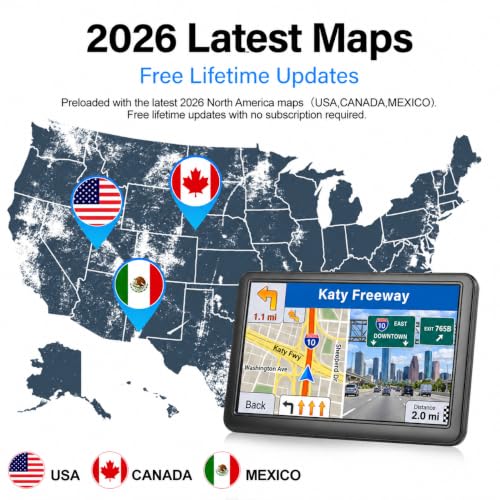
The manufacturer advertises free lifetime map updates without a recurring subscription.
Keeping the navigation database current can help account for supported changes to roads, intersections, and routing information.
Important: Lifetime updates are subject to the manufacturer’s update policy, continued map availability, and device support. Confirm the update procedure and applicable terms before purchasing.
The supplied listing does not identify whether updates require a computer, memory card, or another connection method.
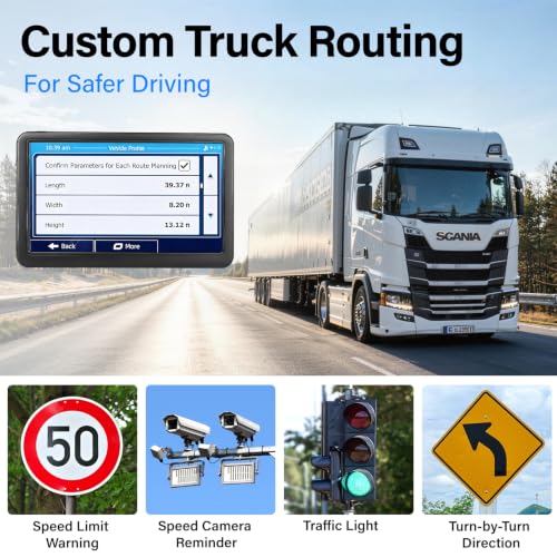
Custom Truck and RV Routing
One of the most important features of this GPS navigator is its advertised support for vehicle-specific route planning.
Unlike basic navigation systems that calculate routes primarily for passenger cars, this device allows users to enter supported vehicle dimensions.
Customizable Vehicle Settings
- Vehicle height
- Vehicle weight
- Vehicle width
- Supported vehicle type
These settings can help the navigation software identify certain roads that may be unsuitable for larger vehicles.
Potential routing considerations include:
- Low bridge clearances
- Weight-restricted roads
- Height restrictions
- Narrow roadways
- Other supported vehicle limitations
This feature can be useful for drivers operating RVs, delivery trucks, pickups with trailers, and larger commercial vehicles.
Important Commercial Vehicle Safety Note
Truck-specific routing is a planning aid, not a guarantee that every suggested route is legally or physically suitable.
Drivers must independently verify posted restrictions, bridge clearances, vehicle weight limits, road conditions, and applicable commercial vehicle regulations.
Never rely exclusively on GPS directions when operating an oversized or commercial vehicle.
7-Inch HD Touchscreen Display
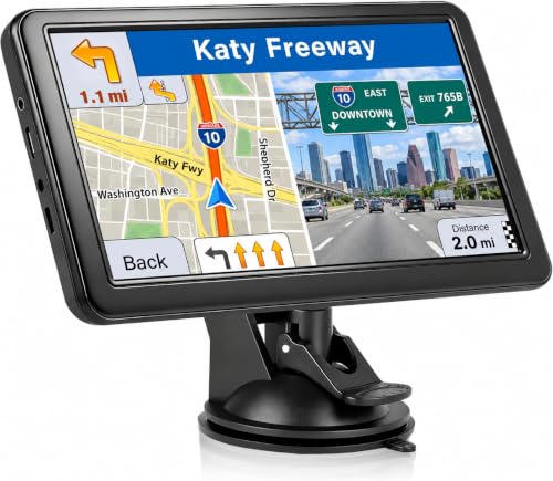
The navigator features a 7-inch touchscreen designed to provide a convenient view of maps, upcoming turns, and route information.
The larger display helps drivers view navigation instructions without depending on a smartphone.
Display Features
- 7-inch touchscreen
- HD display advertised
- 2D map mode
- 3D map mode
- Automatic day and night display modes
- Touchscreen destination entry
The manufacturer advertises clear viewing under different lighting conditions.
However, the supplied product information does not specify the exact pixel resolution or brightness rating.
Spoken Turn-by-Turn GPS Navigation
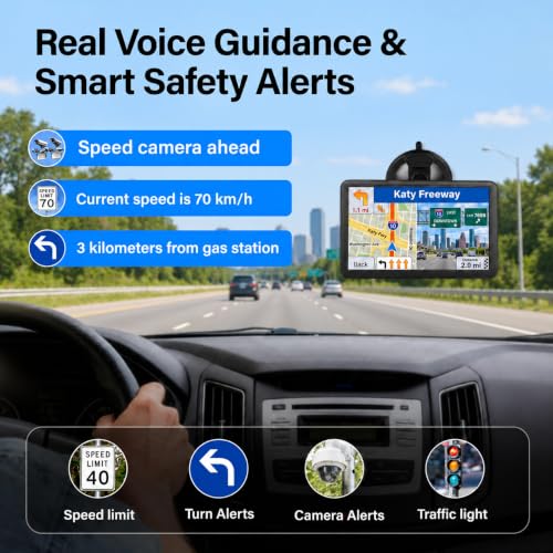
The system supports real voice navigation guidance in multiple languages.
Spoken directions can help drivers follow routes without repeatedly looking at the display.
Supported guidance may include:
- Upcoming turns
- Highway exits
- Route changes
- Lane information
- Destination arrival instructions
The exact supported languages and voice options are not listed in the supplied specifications.
Smart Road Safety Alerts
The GPS navigator advertises several road awareness features designed to provide additional information during travel.
Speed Limit Alerts
Displays or announces supported speed limit information based on available map data.
Red-Light Camera Alerts
Provides notifications for supported camera locations where legally permitted and included in the device’s database.
Sharp Curve Warnings
Alerts drivers to certain curves or potentially challenging road sections.
Lane Guidance
Helps drivers identify appropriate lanes for upcoming turns or highway exits where supported.
School Zone Alerts
Provides notifications for supported school zones included in the map database.
Road Hazard Warnings
Additional alerts may be available for certain road conditions or mapped hazards.
Safety note: Alert availability and accuracy depend on map coverage and database updates. Posted signs and actual road conditions always take priority over GPS information.
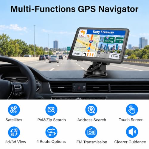
Four Smart Route Planning Options
This navigator offers four advertised route calculation modes.
Fast Route
Prioritizes reaching the destination quickly according to the navigation software’s routing calculations.
Green Route
Designed to consider fuel-efficient or economical routing preferences.
Shortest Route
Prioritizes minimizing travel distance where possible.
Relaxed Route
Provides an alternative routing preference intended for a more comfortable driving experience.
The exact calculation criteria for Green and Relaxed modes are not specified by the manufacturer.
Drivers can select the route option that best matches their travel needs.
Address, ZIP Code, and Points of Interest Search
The navigation system supports several ways to find destinations.
Address Search
Enter a supported street address to calculate a route.
ZIP Code Search
Search for destinations using supported postal code information.
Points of Interest
Find destinations such as:
- Gas stations
- Restaurants
- Hotels
- Shopping centers
- Parking areas
- Other mapped locations
Available points of interest depend on the installed map database and geographic coverage.
FM Audio Transmission Through Your Car Speakers
The GPS navigator includes an FM transmitter designed to play compatible navigation voice guidance through a vehicle’s FM radio.
This can be useful in vehicles where the navigator’s built-in audio is difficult to hear over road noise.
How FM Audio Transmission Works
- Select an appropriate FM frequency on the GPS navigator.
- Tune your vehicle’s FM radio to the matching frequency.
- Configure the device’s audio output according to its instructions.
- Listen to supported navigation voice guidance through the vehicle speakers.
Audio clarity may vary depending on local FM interference and vehicle radio performance.
Standalone GPS Navigation Without Continuous Cellular Service
A dedicated GPS navigator offers several advantages for drivers who frequently travel outside major metropolitan areas.
Because the device includes preloaded maps, ordinary route guidance does not depend on continuously downloading map data through a smartphone.
This makes it useful for:
- Long-distance road trips
- RV travel
- Rural highways
- Cross-country driving
- Delivery routes
- Older vehicles without built-in navigation
Important: The supplied specifications do not confirm live traffic reporting, cellular connectivity, Wi-Fi connectivity, or real-time road closure information.
A Practical GPS Upgrade for Older Cars, Trucks, and RVs
Older vehicles often lack factory navigation or modern infotainment systems.
Replacing the original stereo can require dashboard conversion kits, wiring harnesses, and additional installation work.
A portable GPS navigator provides a dedicated navigation solution without requiring an Apple CarPlay or Android Auto connection.
For example, owners of older Toyota, Honda, Lexus, Nissan, Ford, Chevrolet, and Dodge vehicles can add a dedicated navigation display while retaining their original stereo.
For truck and RV owners, the advertised vehicle-specific routing features add another layer of route planning beyond ordinary passenger car navigation.
Product Specifications
| Specification | Details |
|---|---|
| Product type | Dedicated GPS navigation system |
| Color | Blue |
| Display size | 7 inches |
| Display type | HD touchscreen |
| Exact display resolution | Not specified |
| Preloaded maps | 2026 North America maps advertised |
| Geographic coverage | United States, Canada, Mexico |
| Map updates | Free lifetime updates advertised |
| Vehicle profiles | Car, truck, RV, pickup, commercial vehicle |
| Vehicle dimensions | Height, weight, width |
| Custom truck routing | Supported |
| Turn-by-turn guidance | Spoken voice directions |
| Languages | Multiple; exact list not specified |
| Speed limit alerts | Advertised |
| Red-light camera alerts | Advertised |
| Sharp curve alerts | Advertised |
| School zone alerts | Advertised |
| Lane guidance | Advertised |
| Road hazard alerts | Advertised |
| Map views | 2D and 3D |
| Display modes | Automatic day and night |
| Route options | Fast, Green, Shortest, Relaxed |
| Destination search | Address, ZIP code, points of interest |
| Audio transmission | FM transmitter |
| Smartphone required for ordinary navigation | No |
| Live traffic | Not specified |
| Mounting accessories | Not specified |
| Manufacturer | Not specified |
| Warranty | Not specified |
Frequently Asked Questions
Does this GPS navigator include 2026 maps?
Yes. The manufacturer advertises preloaded 2026 maps covering the United States, Canada, and Mexico.
Are map updates free?
The manufacturer advertises free lifetime map updates without a subscription. Actual availability is subject to its support policy.
Does it support truck-specific navigation?
Yes. Vehicle-specific routing is advertised for trucks, RVs, pickups, and commercial vehicles.
Can I enter my vehicle’s height and weight?
Yes. The navigator supports height, weight, and width settings.
Will it automatically avoid every low bridge?
No GPS system can guarantee this. Drivers must verify posted bridge clearances and road restrictions independently.
Does it require a smartphone?
No. The system uses preloaded maps for ordinary standalone navigation.
Does it work without cellular service?
Preloaded map navigation does not require continuous cellular data, although GPS satellite reception and current map coverage are necessary.
Does it provide voice directions?
Yes. Spoken turn-by-turn guidance in multiple languages is advertised.
Can I hear directions through my car speakers?
Yes, where compatible, using the built-in FM transmitter and your vehicle’s FM radio.
Does it support 2D and 3D maps?
Yes. Both map viewing modes are advertised.
Does it provide live traffic information?
Live traffic capability is not confirmed in the supplied specifications.
Is this an Apple CarPlay or Android Auto display?
No. It is advertised as a dedicated GPS navigator rather than a smartphone-based CarPlay or Android Auto system.
Navigate Smarter with a Dedicated 7-Inch GPS Navigator
The 7-Inch GPS Navigator for Car, Truck, and RV with 2026 North America Maps combines standalone navigation, custom vehicle routing, multilingual voice guidance, and intelligent road alerts in one portable touchscreen device.
With manufacturer-advertised free lifetime map updates, four route planning options, and FM audio transmission, it offers a practical navigation solution for everyday drivers and long-distance travelers.
Shop GPS Navigation Systems at Pro Street Online and explore portable navigators, car electronics, and accessories for cars, trucks, and RVs.






There are no reviews yet.